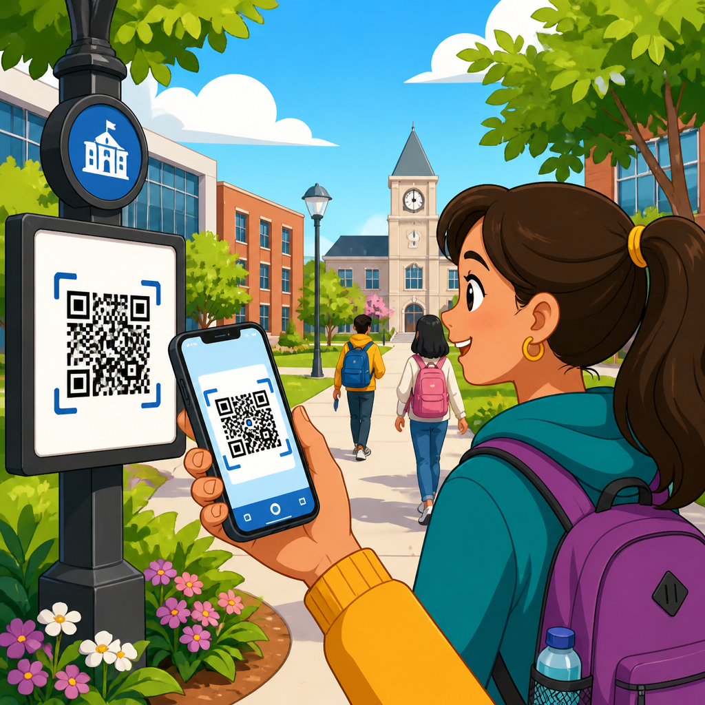
QR codes for campus navigation solve a stubborn problem in education: helping students, staff, visitors, and delivery drivers find the right building, entrance, office, classroom, lab, or parking area without confusion. A campus may look simple on a brochure, yet in practice it includes multiple addresses, disconnected wings, restricted doors, temporary closures, accessibility routes, shuttle stops, and event-based traffic patterns. In that environment, a printed map alone is rarely enough. A QR code placed on signs, directories, parking confirmations, orientation packets, and student portals can send a person directly to the exact digital destination they need, whether that is an interactive map, a walking route, an accessible entrance, or a department page with live directions.
In education, campus navigation includes more than wayfinding. It also covers arrival management, visitor check-in, emergency rerouting, accessibility support, multilingual guidance, and movement between physical and digital services. I have seen institutions reduce front-desk interruptions simply by replacing vague “You Are Here” posters with QR-enabled directories that open turn-by-turn walking routes. The technology is straightforward: a two-dimensional barcode stores a URL or other data, and a smartphone camera reads it instantly. The strategic value comes from how schools structure the destination experience. Static codes point to fixed information, while dynamic codes redirect to updated content without reprinting the sign, making them far more practical for changing campuses.
This matters because higher education and K–12 environments are operationally complex. New students arrive under stress. Parents visit only once or twice and do not know building names. Adjunct faculty may teach in unfamiliar rooms. Conference guests arrive outside normal hours. Accessibility expectations are rightly higher, and institutions must support wheelchair users, people with low vision, non-native speakers, and anyone navigating an unfamiliar site. At the same time, schools are under pressure to improve service without adding staff. QR codes for campus navigation offer a low-cost, scalable layer that bridges physical signage and live digital guidance. Used well, they improve experience, reduce delays, and make the entire education environment feel more organized and welcoming.
Why QR codes fit education campuses so well
Education campuses are unusually suited to QR-based navigation because they combine recurring users with first-time visitors. Students may learn core routes quickly, but many destinations remain unfamiliar: registrar offices, testing centers, counseling services, stadium gates, internship fairs, financial aid windows, arts venues, and satellite classrooms. A QR code can shorten the gap between arrival and confidence. Instead of reading a dense directory and guessing, the user scans and opens a mapped destination that reflects current conditions. This is especially useful at institutions with phased construction, shared buildings, or multiple campuses.
Another reason is sign real estate. Schools often try to place too much information on physical signage, creating clutter and decision fatigue. A QR code lets the sign stay readable while extending details digitally. A parking sign can remain simple, while the linked page contains lot rules, permit types, event exceptions, and a route to the nearest elevator. A residence hall lobby sign can link to mailroom hours, RA office directions, and after-hours entry instructions. The code becomes a gateway, not just a label.
Administrative teams also benefit from analytics and control. With dynamic QR code platforms such as Bitly, QR Code Generator Pro, Beaconstac, or Flowcode, facilities and communications teams can update destination URLs, track scan volume by location, and compare traffic during orientation, move-in weekend, or graduation. That data reveals where people get lost, which entrances are overused, and which signs need better placement. In my experience, schools often discover that visitors scan from parking lots and decision points more than from building interiors, which helps prioritize future improvements.
Core campus navigation use cases across the education sector
QR codes for campus navigation support a broad set of education use cases. The first is main-campus wayfinding: entrance monuments, pedestrian crossroads, and outdoor maps linking to interactive campus directories. The second is building-level routing, where lobby signs send users to department suites, lecture halls, elevators, and restrooms. The third is event navigation for commencement, open houses, sports games, and conferences, when temporary routes, overflow parking, or gate changes are common.
K–12 schools use them differently from universities, but the need is just as real. A large high school can use QR codes at visitor parking, front office entry, athletics facilities, and performing arts centers to direct parents and community members. District campuses can link each school sign to a map, office hours, attendance procedures, and secure visitor instructions. Colleges and universities add layers such as residence life, health centers, shuttle systems, and research complexes. Community colleges benefit because many learners commute, attend evening classes, and use multiple buildings over the week.
Navigation QR codes also work as a hub for related services. A code outside the library can open a page with building hours, floor maps, group study room directions, and an occupancy dashboard. A code at a science complex can route users to the nearest accessible entrance and list safety check-in requirements for labs. These examples matter because the best campus navigation experience is not only about geography; it is about removing the next question before the user has to ask it.
Where to place QR codes for maximum scanning and fewer wrong turns
Placement determines adoption. The highest-performing locations are points where users pause and make a decision: parking pay stations, garage elevators, campus gateways, shuttle shelters, residence hall lobbies, building directories, and hallway intersections near elevators or stairwells. Eye-level placement matters. So does contrast, weather resistance, and enough quiet space around the code for older phone cameras to detect it quickly. For outdoor use, matte finishes reduce glare better than glossy laminates, especially in direct sun.
Schools should avoid burying codes inside cluttered notice boards. They should also avoid posting one code at a building entrance if the real confusion starts in the parking lot three hundred yards away. The scan opportunity must happen before the wrong turn. I typically recommend placing codes in sequences: arrival point, building entrance, and internal directory. This creates continuity. If a visitor missed the first sign, the second recovers them without requiring staff assistance.
| Campus location | Primary user question | Best QR destination | Operational benefit |
|---|---|---|---|
| Visitor parking lot | Where do I go from here? | Walking route to admissions or front office | Fewer lost visitors and late check-ins |
| Main entrance monument | Which building is mine? | Interactive campus map with search | Lower call volume to reception |
| Building lobby directory | Which floor or suite? | Interior map and office list | Less hallway confusion |
| Event venue gate | Am I at the right entrance? | Gate-specific event instructions | Faster crowd flow |
| Accessible parking area | What is the accessible route? | Step-free path with elevator details | Better accessibility compliance |
Designing the destination page behind the code
A QR code is only as useful as the page it opens. For campus navigation, that page should load fast, display clearly on a phone, and answer the next three questions immediately: where am I going, how do I get there, and what should I know before I arrive? The strongest pages place a route button above the fold, followed by a short destination description, hours, access notes, and a backup contact method. If the destination changes often, the page should also display a last-updated timestamp.
Plain language matters. Internal campus jargon confuses visitors. “Student Services Annex B” may mean nothing to a parent, while “Financial Aid Office” is instantly useful. Search should support both official and common names. Good destination pages also provide options for Apple Maps, Google Maps, and sometimes Waze, because different users trust different tools. On very large campuses, institutions may use GIS-based maps from ArcGIS Indoors, MazeMap, Mappedin, or Concept3D to support indoor routing, accessible paths, and searchable points of interest.
Accessibility should be built in, not added later. Use high color contrast, descriptive link labels, readable font sizes, and alt text on map images. If the page includes a map screenshot, it should also provide written directions such as “Enter through the east doors, take elevator A to floor 3, suite 310 is on the left.” That text helps screen readers and users who struggle with visual maps. It also improves clarity when a GPS pin is technically correct but practically unhelpful.
Supporting accessibility, safety, and multilingual navigation
One of the strongest arguments for QR codes in education is inclusive navigation. Campuses often assume everyone can use stairs, interpret complex signage, or read English fluently. Real users prove otherwise. A thoughtful QR deployment can direct wheelchair users to curb cuts, power-assisted doors, and elevators that are actually operational. It can show low-vision users concise written directions instead of forcing them to parse a crowded map. It can offer multilingual landing pages for visitors attending international student orientations or community events.
Safety use cases are equally important. During construction, severe weather, or security incidents, dynamic codes can redirect people away from closed paths and toward approved entrances. A code on a residence hall sign might normally open a general building page, but during move-in weekend it can switch to unloading instructions and traffic flow. During a medical clinic event, it can direct visitors to a separate entrance to avoid crowding. Because the printed symbol stays the same, institutions can respond quickly without replacing hardware.
There are limits. QR codes do not replace ADA-compliant physical signage, emergency egress signs, or staffed assistance. They depend on a smartphone, camera access, and at least some network connectivity. For that reason, the best campus navigation systems are layered. Physical signs provide the essential path. QR codes add detail, adaptability, and personalized routing. Schools that treat them as an enhancement rather than a substitute achieve the strongest results.
Implementation strategy for schools, colleges, and universities
A successful rollout starts with a navigation audit. Identify the top confusion points by reviewing front-desk questions, campus police directions calls, admissions complaints, event staff feedback, and accessibility reports. Then rank destinations by importance: admissions, registrar, financial aid, disability services, student health, major lecture halls, visitor parking, and event venues usually come first. Build dynamic codes for those destinations and standardize naming conventions so users see consistent labels across signs, maps, and webpages.
Governance is critical. Someone must own updates when departments move, entrances close, or hours change. On many campuses, the right model is shared ownership: facilities manages map accuracy, communications manages page design, IT manages platform access, and departmental coordinators approve destination content. Use a central spreadsheet or asset management system to track every code, location, destination URL, and maintenance date. Without that inventory, schools lose confidence quickly because one outdated sign can undermine the whole program.
Testing should happen in the field, not only on desktops. Walk routes with first-year students, parents, accessibility staff, and visitors unfamiliar with the campus. Measure time to destination, scan success rate, and points of hesitation. Confirm that codes scan in rain, shade, and bright sunlight. Check multilingual versions with native speakers. Review analytics after launch and refine placements. In several education projects I have worked on, the biggest improvement came not from changing map software but from moving the sign fifteen feet closer to where people actually stopped and looked around.
How this education hub connects to broader QR code use cases
Campus navigation is the hub because it touches nearly every education workflow. Once a school has a reliable QR infrastructure, it can extend the same approach into related use cases across the education sector. Admissions teams can use codes on brochures, banners, and tour stops. Student services can link printed notices to appointment booking, forms, and office locations. Libraries can connect shelf-end signs to floor maps, digital collections, and equipment checkout. Athletics departments can guide spectators to parking, gates, concessions, and accessible seating.
Other education subtopics naturally branch from this page. Visitor management builds on arrival and routing. Classroom engagement uses QR codes inside teaching spaces for attendance, polls, and lesson materials. Facilities and maintenance teams use them for room identification, asset tracking, and service requests. Safety offices use them for emergency instructions, reporting, and muster-point maps. Alumni and advancement teams use them at campus events, donor walls, and museum spaces. In other words, navigation is not an isolated tactic; it is the foundation for a coherent physical-to-digital campus experience.
For education leaders, the takeaway is practical. Start with the routes people struggle to navigate, build clear mobile destinations, and manage the system centrally. If your school already uses QR codes inconsistently, standardize them around navigation first, then expand into admissions, events, student services, and operations. That sequence produces visible wins quickly because wayfinding problems are easy to spot and easy to measure. Review your highest-traffic entrances, parking areas, and directories, then launch a pilot that gives every visitor a faster path to the right place.
Frequently Asked Questions
How do QR codes improve campus navigation compared with printed maps and static signs?
QR codes make campus navigation more practical because they connect people to live, location-specific information at the exact moment they need it. A printed map can show building names and general pathways, but it cannot easily account for temporary closures, restricted entrances, accessibility detours, event traffic, shuttle changes, or department relocations. By scanning a QR code placed at parking lots, building entrances, residence halls, visitor centers, and major intersections, students, staff, visitors, and delivery drivers can instantly access the most current directions for where they need to go.
This matters on campuses that have multiple wings, similar building names, separate street addresses, and specialized destinations such as labs, advising offices, loading docks, or performance venues. Instead of trying to interpret a large map or follow unclear signage, a user can scan and receive turn-by-turn walking directions, the nearest accessible route, the best entrance for their purpose, or a direct link to a campus navigation portal. In effect, QR codes turn static signs into dynamic wayfinding tools.
They also reduce confusion for first-time visitors. Someone attending orientation, a campus tour, a sporting event, or a medical appointment may not understand internal campus landmarks. A QR code can bridge that gap by delivering simplified directions written for non-experts, not just people already familiar with the campus. The result is fewer missed appointments, fewer late arrivals, fewer calls to front desks asking for directions, and a smoother overall campus experience.
Where should campuses place QR codes for the best navigation results?
The most effective QR code placement strategy starts by identifying the moments when people are most likely to get lost or hesitate. These are typically not random locations. They are high-decision points such as parking entrances, parking pay stations, transit stops, campus perimeter signs, pedestrian crossroads, major building entrances, lobby directories, elevator banks, residence hall check-in areas, and event venues. Placing QR codes at these points gives users support precisely when they are deciding where to go next.
Campuses should also think in terms of audience needs. Visitors often need help from the edge of campus inward, so QR codes near visitor parking, welcome centers, and drop-off areas are especially valuable. Students may need route guidance between academic buildings, labs, student services, and dining facilities. Delivery drivers benefit from QR codes near service roads, loading areas, and shipping entrances that clarify where packages should be brought. Accessibility-focused placement is equally important, with codes that help users identify ramps, elevators, automatic doors, and step-free pathways.
Visibility and usability matter just as much as location. QR codes should be large enough to scan easily, placed at a comfortable height, and paired with a clear call to action such as “Scan for walking directions,” “Scan for accessible entrance,” or “Scan for event parking map.” They should appear on durable, weather-resistant signage and be positioned where lighting, glare, and foot traffic will not interfere with scanning. A well-placed QR code is not just technically functional; it is intuitive, obvious, and immediately helpful.
Can QR codes help with accessibility and special routing needs on campus?
Yes, and this is one of the strongest use cases for QR codes in campus navigation. Traditional maps and directional signs often assume a standard walking route, but real users may need routes that avoid stairs, direct them to an elevator, lead them to a wheelchair-accessible entrance, identify accessible parking, or guide them around temporary obstructions. A QR code can link directly to route options tailored to these needs, making navigation more inclusive and far more useful than one-size-fits-all signage.
For example, a building may have a beautiful main entrance that is not the best access point for everyone. A QR code placed near that entrance can immediately direct users to the nearest automatic door, ramp, or accessible service desk. Similarly, during construction or maintenance, accessible paths may need to change quickly. Updating the destination behind a QR code is much simpler than reprinting and reinstalling physical signs across campus, which helps institutions respond faster and maintain more accurate accessibility information.
QR codes can also support visitors with situational needs, not only permanent accessibility requirements. Parents with strollers, guests carrying equipment, vendors making deliveries, or event attendees looking for the simplest entrance all benefit from alternate route guidance. When campuses design QR navigation with accessibility in mind from the start, they improve the experience for everyone while demonstrating a more thoughtful, user-centered approach to wayfinding.
What information should a campus QR code link to in order to be most useful?
The best campus navigation QR codes link to focused information that helps a person complete a specific task quickly. In many cases, that means a mobile-friendly map with a pinned destination and route guidance. However, the most effective implementations go further by including practical details such as the correct entrance, office suite number, parking instructions, building hours, check-in procedures, and notes about restricted access. The goal is not simply to show where a building is, but to help users arrive at the right place within that building.
Different QR codes can serve different navigation scenarios. A code near a parking structure might link to visitor parking instructions and walking routes to nearby departments. A code outside a science building could help students find a specific lab, lecture hall, or advising office. A code at an event venue might direct guests to ticketing, seating entrances, restrooms, and shuttle pickup zones. Delivery-focused codes can provide dock access instructions, receiving hours, and contact numbers, reducing delays and misrouted drop-offs.
It is also important that the linked content works well on a phone. Pages should load quickly, display clearly on small screens, and avoid unnecessary clutter. If possible, campuses should include options for walking, driving, and accessible routes, along with plain-language directions for users unfamiliar with campus terminology. Well-designed QR destinations turn a simple scan into a complete guidance experience, not just a digital version of an already confusing map.
Are QR codes for campus navigation easy to update and manage over time?
Yes, especially when campuses use dynamic QR codes rather than codes tied permanently to a single static URL. Dynamic QR codes allow administrators to change the destination content without replacing the printed sign itself. That means a code installed at a building entrance can continue to be useful even if the office inside moves, a pathway closes for construction, parking rules change, or an event requires temporary rerouting. For campuses that deal with constant operational changes, this flexibility is a major advantage.
Management becomes even easier when QR codes are organized as part of a broader wayfinding system. Institutions can label codes by location, purpose, and audience, then monitor which ones are being scanned most often. This helps reveal where people frequently get confused and where additional signage or content improvements may be needed. For example, if one entrance consistently receives heavy scan activity, that may indicate users need better guidance there, while low engagement at another point may suggest the sign is poorly placed or unclear.
Long-term success depends on governance as much as technology. Someone should be responsible for reviewing linked information regularly, testing scan performance, and updating routes when campus conditions change. With that process in place, QR codes remain accurate, scalable, and cost-effective. Instead of reprinting maps every time a campus layout changes, institutions can maintain a more agile navigation system that keeps pace with everyday operations, special events, accessibility needs, and seasonal traffic patterns.